Last updated 2002-12-22
To give you an impression of what I have achieved so far, here are some images I captured from satellites. Before downloading notice they are about 1 Mbyte each.
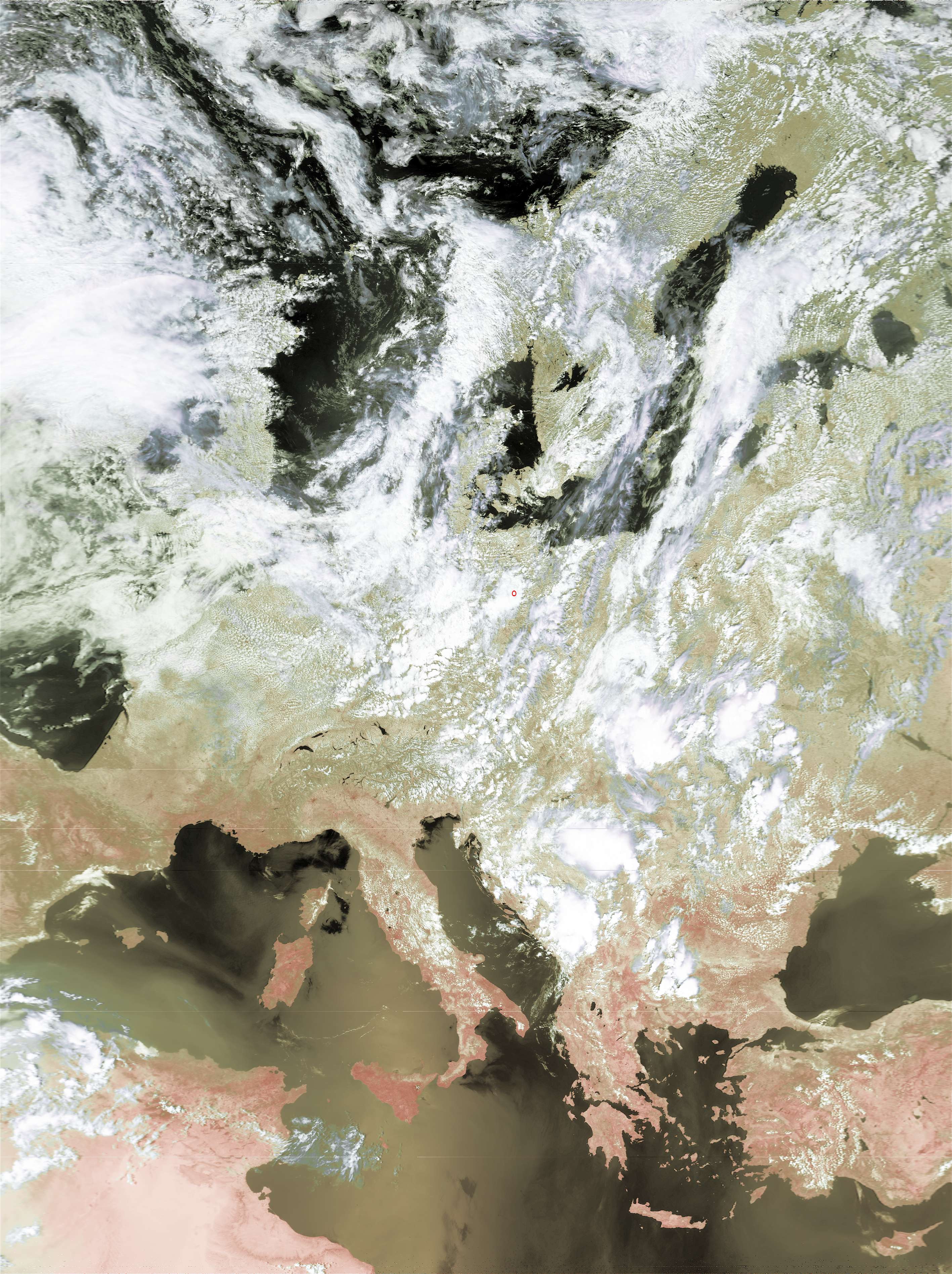
1st image is from NOAA16 at 12:16 UTC on 7-jul-2002
2nd image is from NOAA12 at 15:13 UTC on 05-jul-2002
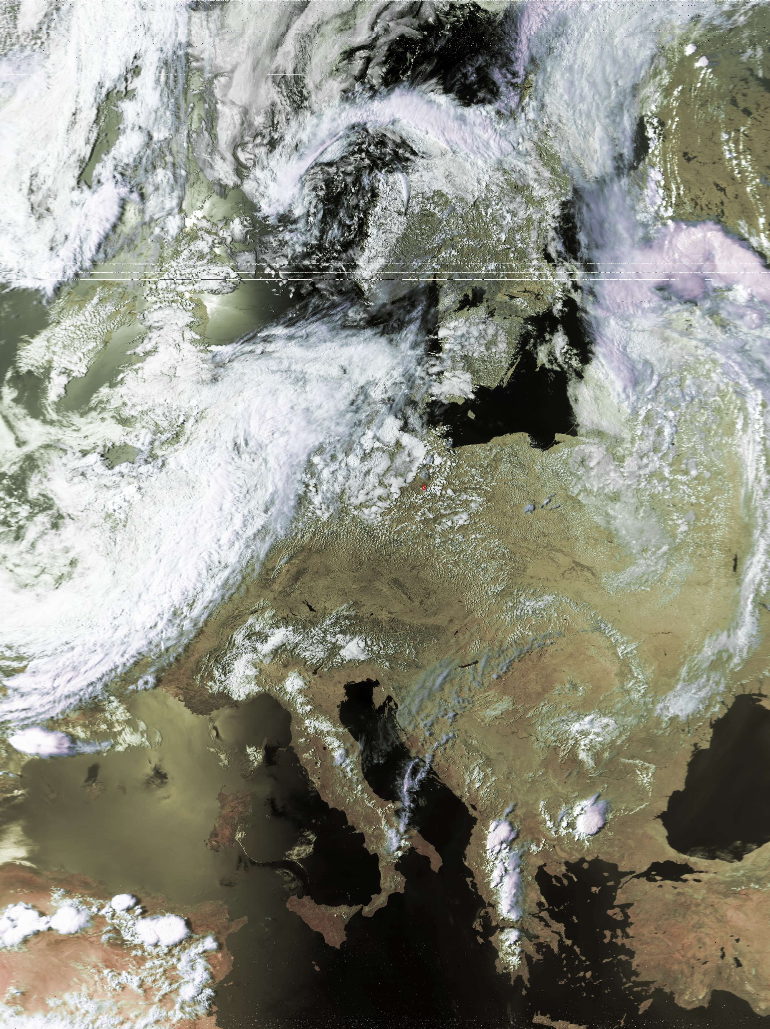
Both pictures are processed by David Taylors HRPTreader only and geometrically corrected. No other sort of enhancement or postprocessing ( ie. descratching with Paintshop Pro etc. ) was done.
You will easily recognize some dropouts due to some trees occluding direct view to the satellites. Synchronization of Alblas decoder starts at about ten degrees above horizon. This is not (!!) limited by antenna gain or preamp sensitivity but rather by buildings and trees.
Look for the red circle marking my home location.
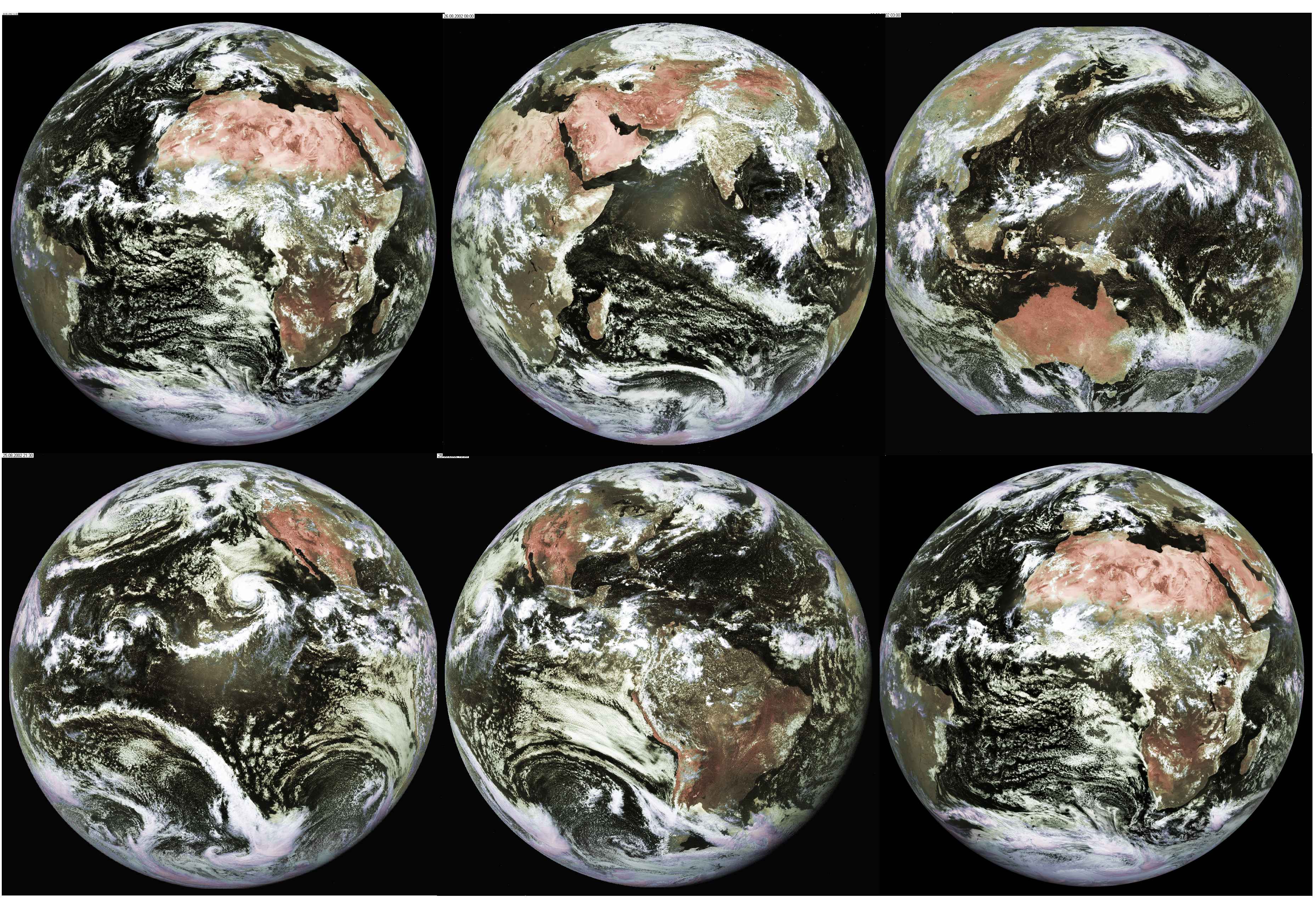
A compilation of 5 different images received in HRI-format via
Meteosat-7 ( PDUS ) processed by Taylor's GeoSatSignal to form a
"trip around the world in 24 hours". Images were captured with my
135cm prime focus dish antenna and my van Rotten/van Belle HRPT/HRI
receiver within 24 hours. Europa and Africa is Meteosat A format,
the other images are from GMS, GOES-E, GOES-W and Meteosat 5
respectively and were retransmitted via Meteosat-7.